SEPTEMBER 21, 2025 ANNA, MELISSA & SANGER HAIL: THE VERIFIED REPORT LOG
Yes — NWS-verified hail crossed northern Denton and Collin counties on Sunday evening, September 21, 2025. The reports run from 5:31 to 6:39 PM as storms rode both highways south: quarter-size hail at Sanger on the I-35 line — with a wall collapse at a distribution center and overturned campers at the KOA behind it — then golf-ball hail at Anna at 6:16 PM and hen-egg 2.00-inch hail northeast of Melissa at 6:25 PM on the US 75 line. A second round came through overnight: a measured 72 mph gust at Ponder at 3:49 AM and northbound I-35W in Denton closed by high water before the Monday commute.
NWS-verified hail fell across northern Denton and Collin counties between 5:31 and 6:39 PM on Sunday, September 21, 2025. The largest stone verified inside the four core DFW counties was hen-egg size — 2.00″ northeast of Melissa at 6:25 PM — nine minutes after golf-ball hail (1.75″) fell at Anna. On the I-35 side, Sanger took quarter-size hail twice around 5:31–5:35 PM while straight-line wind partially collapsed a wall at a distribution center and flipped campers at the Sanger KOA; Denton proper logged penny-size hail and measured gusts of 60 to 68 mph. Just north of the county line the same storms dropped 2.50″ stones at Luella and southeast of Howe, where eight to ten minutes of hail broke windows. A second overnight round pushed a measured 72 mph gust through Ponder at 3:49 AM and closed northbound I-35W at Oak Street in Denton under high water before the Monday commute — damage from that round carries a September 22 date of loss. Hail, wind-blown debris and flood damage are all comprehensive claims, and Texas rule 28 TAC §5.7016 bars nonrenewal solely over weather claims. And no, late-September hail is not a fluke: this was one of 21 fall days since 2015 with inch-plus hail in the core counties — September 21 is on that list twice.
- Biggest core-county stone: 2.00″ (hen egg) northeast of Melissa, 6:25 PM — with 1.75″ golf ball at Anna at 6:16 PM.
- The I-35 side: quarter-size at Sanger (5:31 and 5:35 PM), 1.25″ southeast of town, a partial wall collapse and overturned campers — Denton itself took penny hail and 60–68 mph gusts.
- North of the county line: 2.50″ measured at Luella and southeast of Howe — where sustained hail broke windows — 2.00″ south of Valley View.
- The overnight round: 72 mph at Ponder at 3:49 AM, I-35W closed by water in Denton, tree damage in Roanoke — that damage dates September 22, not 21.
- Reports are point samples: the log proves hail was falling along both highway corridors — it does not list every street it hit.
Straight From The NWS
EVERY VERIFIED DENTON & COLLIN COUNTY REPORT FROM SEPTEMBER 21, 2025
The table below is the National Weather Service Fort Worth office’s local storm report log for Sunday evening, September 21, 2025, filtered to Denton and Collin counties, with times converted to local Central time. We didn’t write these; spotters, emergency managers, broadcast meteorologists and the public did, and the NWS published them. You can check the raw federal record on the Storm Prediction Center’s report page for September 21, 2025 or through NWS Fort Worth. Because this page was written long after the event, the log below is the final record — every late and delayed report is in.
Times converted to Central time from the NWS log. Source: NWS Fort Worth local storm reports, September 21, 2025. Rows marked mPING are public reports submitted through the NWS’s Meteorological Phenomena Identification Near the Ground project and published in the official log alongside spotter and emergency-management reports.
Read as a map, the log shows storms working down both highways at once. On the I-35 side: hail and wind at Sanger from 5:31, half-dollar hail southeast of town at 5:57, then measured gusts marching through Denton — 64 mph at Hwy 288, 60 mph at the airport, 68 mph at TWU — with penny hail on the city’s north side at 6:22. On the US 75 side: the cell that had just dropped measured 2.50″ stones in Grayson County crossed the county line and hit Anna at 6:16, Melissa at 6:25. And the usual caveat, honest in both directions: these are point observations. A report exists only where someone stood, measured and submitted. A car parked between Anna and Melissa that evening was almost certainly under the same core that produced both reports — and a clean log line for your exact street proves nothing either way. The log tells you whether to go look. Your hood tells you the rest.
Context: Grayson & Cooke Counties
THE BIGGEST STONES FELL JUST NORTH OF THE COUNTY LINE
The same evening’s storms were even stronger before they reached Denton and Collin counties. This matters to metro drivers for a simple reason: US 75 and I-35 carry thousands of DFW cars through Grayson and Cooke counties on a Sunday evening — a trip home from Lake Texoma or Winstar timed exactly wrong put a car under stones that break glass.
Same source and time conversion as the main table. Grayson and Cooke counties sit outside the four core DFW counties this site’s hail dataset tracks — shown here because the storm didn’t care about the county line.
The Howe report deserves a second read: eight to ten minutes of 2.25-to-2.5-inch hail, with broken windows. Duration is the quiet variable in hail damage — a thirty-second burst of two-inch stones dents a hood; ten minutes of them exhausts every panel on the car and starts breaking glass. When that same line of storms crossed into Collin County twenty-five minutes later it had eased to hen-egg and golf-ball sizes — still comfortably above the threshold where total-loss math becomes a real question on an older vehicle.
Where It Hit
SANGER, ANNA & MELISSA, DENTON, PONDER & ROANOKE: CITY BY CITY
Sanger and the I-35 corridor took the evening’s first metro-county hits, and took them three ways at once: quarter-size hail east and north-northwest of town at 5:31 and 5:35 PM, half-dollar hail southeast at 5:57 — and straight-line wind strong enough to partially collapse a wall at a distribution center and flip multiple campers at the Sanger KOA on I-35 near View Road. Power poles went down on Belz Road. Wind that moves a camper moves whatever was parked next to it, and it turns fence sections, limbs and shingles into things that land on hoods. If a vehicle sat outside in Sanger that evening — a driveway, the I-35 frontage lots, an RV at the KOA — both hail dents and debris strikes belong on the same September 21 comprehensive claim.
Anna and Melissa are the headline inside the four core counties. Golf-ball hail hit Anna at 6:16 PM, half-dollar two miles southwest a minute later, quarter-size west of town at 6:23 — and then the biggest verified core-county stone of the evening, hen-egg 2.00″ hail two miles northeast of Melissa at 6:25 PM, with quarter and dime reports following as the core slid southeast. Stones that size dent vertical panels — doors, fenders — split trim and mirror caps, and on the aluminum hoods and tailgates that dominate this corridor’s driveways they leave deep, work-hardened strikes that reward proper technique and punish shortcuts; the metal-by-metal story is on our F-150 hail page and its Silverado & Sierra twin. We’ll be straight about geography: Anna and Melissa are 45-odd miles up US 75 from our Lewisville shop — not around the corner. That’s well inside our free 75-mile pickup radius, which exists for exactly this storm: we come get the truck, you keep your Monday.
Denton itself caught the edge of the I-35 core rather than its center: penny-size hail fell for about five minutes on the city’s north side at 6:22 PM — below the size that usually marks steel body panels, worth a check on soft aluminum — while the measured wind told the bigger story: 64 mph at Hwy 288 and I-35, 60 mph at Denton Enterprise Airport, 68 mph at TWU. Gusts in that range snap limbs onto parked cars across a whole city. Denton’s full storm-by-storm hail record — including the grapefruit-size stones of 2016 and 2017 — lives on our Denton hail repair page, and the inch-plus line this particular evening ran from Sanger north, not through the city core.
Ponder, Krum, Justin and Roanoke belong to the overnight round, not the evening one. At 3:49 AM Monday a weather station in Ponder measured a 72 mph gust — the strongest wind report of the whole event in Denton County — with large tree damage southeast of FM 156 and FM 2449, minor roof damage, downed fences and broken limbs behind it. By first light, emergency managers were logging roads closed under high water: C Wolfe in Ponder, Mousehole, Jackson and Radecke in Krum, Swafford and Linnie Bell in Justin, and Rector Road near Sanger. In Roanoke, an NWS analysis of the tree damage afterward put the winds at up to 60 mph. A car that went to bed clean on Sunday and woke up dented, scratched or flooded on Monday is that round’s signature — and its date of loss is September 22, which the next section untangles.
FOUND DENTS YOU CAN’T DATE?
A written dent count under PDR lighting ties damage to a storm the NWS can verify. Free, documented, no obligation to file — and if the count won’t clear your deductible, we’ll tell you that too.
One Storm, Two Dates Of Loss
SEPTEMBER 21 OR SEPTEMBER 22? GETTING THE DATE RIGHT
This event ran in two rounds separated by most of a night, and that splits the paperwork. Hail damage carries a September 21, 2025 date of loss — every hail report in the log landed between 5:21 and 6:39 PM Sunday. Wind, debris and flood damage discovered Monday morning most likely carries September 22 — the Ponder gust hit at 3:49 AM, northbound I-35W at Oak Street in Denton was closed by high water by 4:45 AM, and the Roanoke tree-damage analysis and the county road closures were logged from 5:30 AM on. Collin County’s Monday kept going: two house fires in Princeton’s Brookside neighborhood, possibly caused by lightning, near 11:15 AM, and street flooding with stranded vehicles west of New Hope before noon.
Why the date matters: your insurer will verify the date of loss against the same federal record this page is built on, and a mismatched date is the easiest way for a claim to start on the wrong foot. One wrinkle to know when checking for yourself: the Storm Prediction Center’s “day” runs 7 AM to 7 AM Central, so its September 21 page carries both the Sunday-evening hail and the pre-dawn Monday wind. Flood and lightning entries live in the NWS local storm report database rather than SPC’s severe-weather tables. If your car took hail Sunday and a limb or high water Monday, that’s still one storm system — talk to your adjuster about how they want it filed before assuming it’s two claims and two deductibles.
From Our Own Dataset
LATE-SEPTEMBER HAIL ISN’T A FLUKE — IT’S THE SECOND SEASON
We keep the full NWS report log for Dallas, Denton, Tarrant and Collin counties going back to 2015 — the same dataset behind our DFW hail season guide — and it says autumn hail is a pattern, not an accident. Since 2015 the four core counties have logged 21 September-through-November days with inch-or-larger hail. Nine of those are September days. The biggest fall stone in the log is a 3.00″ monster from October 10, 2019.
And September 21 specifically is a repeat offender: the same calendar date produced inch-plus core-county hail in 2023 — a day that peaked at 2.50″ — and again in 2025, the storm on this page. This 2025 event wasn’t even the month’s first: September 5, 2025 had already put inch-plus hail in the core counties sixteen days earlier. The practical takeaway is the one we repeat every year: the spring peak gets the headlines, but the car cover, the garage spot and the covered parking at work still earn their keep from September to Thanksgiving. Storms in the second season also tend to arrive exactly like this one did — a Sunday-evening line, then a ragged overnight round — which is why so much fall damage gets discovered days late, in a parking lot, at the wrong angle of sunlight.
The Insurance Side
CLAIMING SEPTEMBER 21, 2025 DAMAGE THIS LONG AFTER THE STORM
Hail, wind-blown debris and flood water are all comprehensive claims: no fault, no points, nothing on your driving record. Texas rule 28 TAC §5.7016 bars insurers from refusing to renew a personal auto policy solely over weather claims, and the honest math on what a comprehensive claim does and doesn’t do to your premium is in our rates guide.
Now the part most pages won’t say plainly: a claim this long after the storm is a harder conversation than one filed the same month, and pretending otherwise would be selling you something. Texas law sets no filing statute, but the policy does: most carriers hold hail claims to a window of about one year from the date of loss, sometimes less — and this storm has now reached that line. If you intend to file, treat today as the deadline, not the warm-up. What closes that room is documentation: a written, panel-by-panel dent count that matches this storm’s verified sizes and locations, dated photos, and the federal record this page links. Where this page keeps mattering either way: a claim already on file, which the record anchors; a trade-in or lease-return inspection that priced old hail against you — proving age cuts both ways; and the messiest case — a car that’s been through this storm and a 2026 storm, where the carrier needs damage split between two dates of loss. That split is exactly what a documented estimate is for; the step-by-step filing walk-through is in our Texas hail claim guide.
Your deductible: on qualifying hail claims we cover the first $1,000 of it from our own margin as a repair credit — the estimate and the bill to your insurer stay 100% honest, which is what keeps deductible assistance legal on a Texas auto claim. You file the claim; we document, photograph and handle the adjuster correspondence from there. The shop is your call, not your carrier’s — Tex. Ins. Code §1952.301 — and most hail at this storm’s sizes is paintless dent repair territory when the paint held.
One last observation with a moral in it. The tents and door-knockers that followed this storm through Anna, Melissa and Sanger in September 2025 were gone by Thanksgiving — that’s not a guess, it’s their business model, and it’s why every warranty they offered is now a phone number that rings nowhere. If a traveling crew repaired your hail back then and the panels are showing it, or another storm finds you first this fall, the nine tells that separate a real shop from a folding table are in our hail scams guide — including the question we tell everyone to ask before signing anything: where will you be in March? Our answer has been the same address in Lewisville since 1978.
Better Late Than Never
CHECK YOUR CAR FOR SEPTEMBER 21 HAIL IN 5 STEPS
01. Walk the car in raking light
Early morning or an hour before sunset, crouch so light skims the hood, roof and trunk at a low angle. Year-old hail dents hide exactly as well as fresh ones — until the light comes in flat. Run a dry microfiber across the panels; your hand catches what your eye misses.
02. Photograph everything, dated
Wide shots of each panel plus close-ups of the worst strikes, with your phone’s date stamp intact. Golf-ball and egg-size hail marks doors and fenders too, so shoot the vertical panels — and any scratch, chip or water line that could belong to the overnight round.
03. Get the written dent count first
Free at our shop, under proper PDR lighting. On a late claim the written count is your whole case: panel by panel, sized and dated, consistent with what the NWS log says fell at your location on September 21, 2025. No obligation either way — and if it won’t clear your deductible, we say so.
04. File with the right date of loss
Hail from the Sunday-evening round is September 21, 2025; wind, debris and flood damage found Monday morning is September 22. Both are comprehensive — no fault, no points. Give your carrier the date, reference the NWS record, and let the documentation do the arguing. You file; we take it from the claim number.
05. Pick your shop — it’s your legal right
Tex. Ins. Code §1952.301: your insurer cannot dictate the shop. Hail at this storm’s sizes is mostly paintless dent repair when the paint held — factory finish kept, the first $1,000 of your deductible covered on qualifying claims, free pickup up to 75 miles out, free loaner while we work.
From Our Shop Floor
WHAT HAIL REPAIR LOOKS LIKE DONE RIGHT
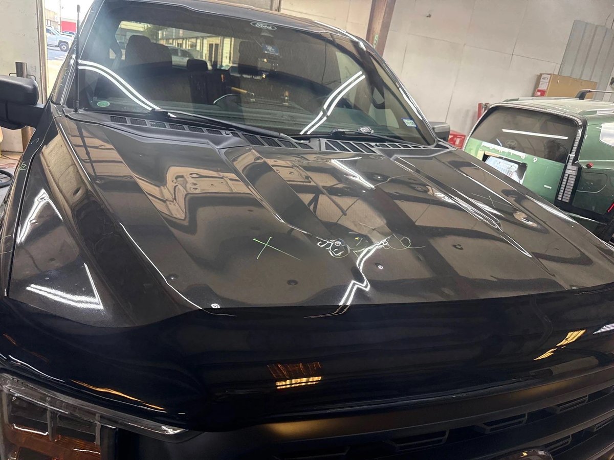
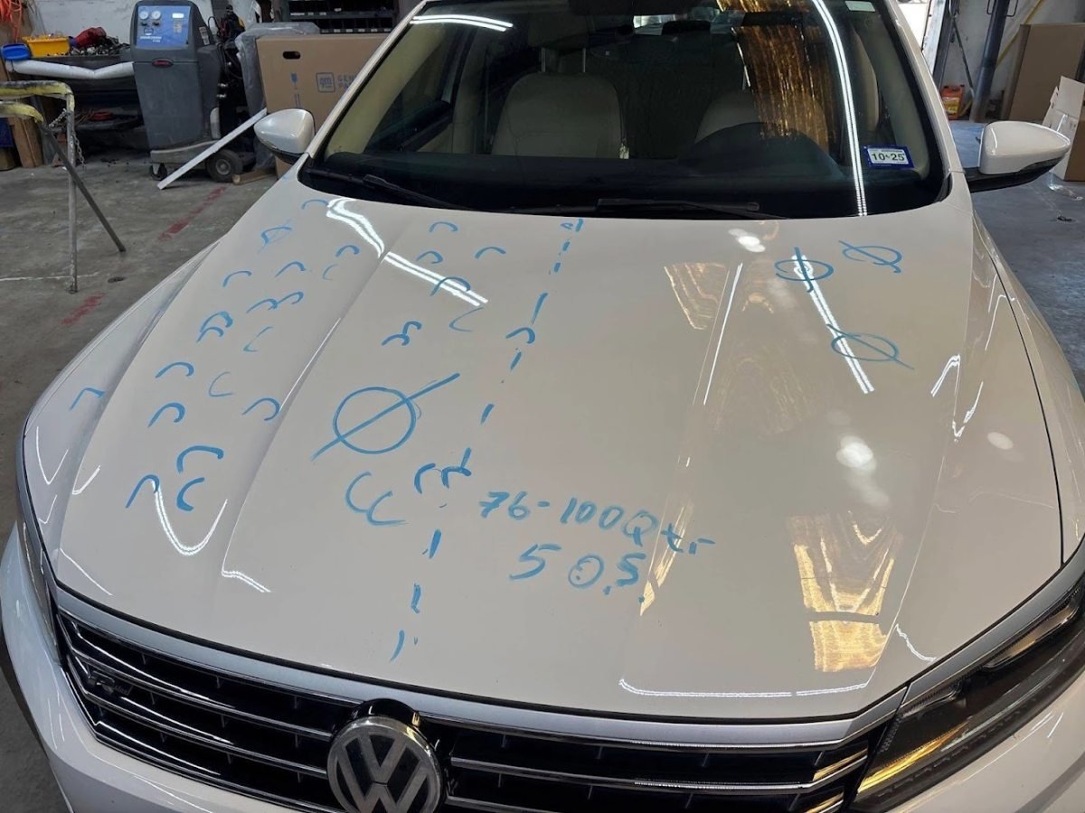
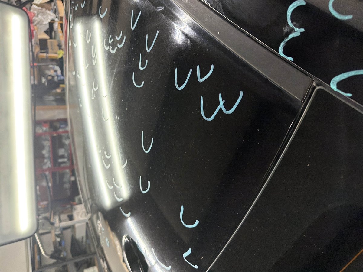
These are real repairs from our Lewisville shop floor — shown so you can see what the process produces, not photos from the September 21, 2025 storm. Drag the slider.
 Before
After
Before
After
F-150 Aluminum Hood — Hail PDR, No Repaint
Pictured: a customer’s F-150 — the aluminum-bodied truck this corridor drives, worked slow and warm so the work-hardened metal releases instead of cracking; the same class of damage golf-ball hail leaves
September 21, 2025 Storm Questions