JUNE 1, 2025 EVERMAN, ARLINGTON & WEATHERFORD HAIL: THE VERIFIED REPORT LOG
Yes — NWS-verified hail crossed Tarrant, Dallas and Parker counties on Sunday evening, June 1, 2025, and it came from two supercells working at once. The first opened over the Crowley–Everman corridor at 6:54 PM and peaked two minutes later with a 3.00″ “apple size” stone in far south Fort Worth, then marched northeast — tennis-ball hail in Arlington at 7:23, a hen egg near Collins and Mayfield at 7:41 — and crossed the county line into Grand Prairie at 7:49. The second rode I-20 out of the west and spent thirty-four minutes on Weatherford: three separate 3.00″ reports and hail covering the ground in town.
Two supercells hit the western metro on Sunday evening, June 1, 2025. The first put 41 NWS-verified hail reports across Tarrant and Dallas counties between 6:54 and 8:01 PM: a 3.00″ stone photographed in far south Fort Worth near Everman at 6:56 — “apple size,” in the log’s own words — a delayed baseball report from Everman itself, hen eggs at Kennedale and Edgecliff, a 2.50″ tennis ball at Polly Webb and Green Oaks in Arlington at 7:23, a hen egg northeast of Arlington at 7:41, and a hen egg one mile southeast of Grand Prairie at 7:49 as the cell crossed the county line. The second supercell announced itself near Millsap at 7:43, then spent 8:12 to 8:46 PM on Weatherford: 3.00″ hail three separate times, a 2.50″ tennis ball, two inches measured a mile west of Weatherford High School, and “quarter to golf ball sized hail covering the ground.” Everything fell on one calendar date, so every claim from this event carries a June 1, 2025 date of loss. Hail is a comprehensive claim — no fault, no points — and Texas rule 28 TAC §5.7016 bars nonrenewal solely over weather claims. This storm runs through six of the thirty-eight community hail tables we publish, which is exactly why we built it its own page.
- Biggest stones: 3.00″ near Everman at 6:56 PM — then 3.00″ three more times around Weatherford, at 8:15, 8:20 and 8:33.
- The first cell’s march: Crowley 6:54 → Everman 6:56 → Kennedale 7:19 → Arlington 7:23–7:42 → Grand Prairie 7:49.
- The second cell’s finale: Millsap 7:43–8:06 → Weatherford 8:12–8:46 → Hudson Oaks and Willow Park to 8:48.
- One date of loss: everything landed the same Sunday evening — June 1, 2025, start to finish.
- Reports are point samples: the log proves what fell where someone stood and measured — it does not list every street the cores crossed.
Straight From The NWS
ALL 41 VERIFIED TARRANT & DALLAS COUNTY REPORTS FROM JUNE 1, 2025
The table below is the National Weather Service Fort Worth office’s local storm report log for Sunday evening, June 1, 2025, filtered to the core metro counties, with times converted to local Central time. Spotters, ham radio operators, emergency managers and the public filed these; the NWS published them; we’re only laying them end to end. The raw federal record is on the Storm Prediction Center’s report page for June 1, 2025 and through NWS Fort Worth. Because this page went up long after the event, the log is the final record — every late and delayed report is in. Where several public reports landed within a couple of minutes of each other, we’ve grouped them into one row and said how many are behind it; the significant stones each keep their own line.
Times converted to Central time from the NWS log. Source: NWS Fort Worth local storm reports, June 1, 2025. The fifteen rows above carry all 41 verified core-county hail reports from that evening; grouped rows state how many individual reports they hold. Rows marked mPING are public reports submitted through the NWS’s Meteorological Phenomena Identification Near the Ground project and published in the official log alongside spotter and emergency-management reports.
Earlier that afternoon the same system had already been working Johnson County: quarters near Lake Pat Cleburne at 4:58 PM, a two-inch report near CR 1219 and Nolan River Road west of Rio Vista at 5:11, penny-to-quarter stones on CR 204 near Grandview, and quarters on FM 916 at the Ellis County line by 5:20. And the standing caveat, honest in both directions: these are point observations. A report exists only where someone stood, measured and submitted. A car parked between Kennedale and the Arlington hen-egg pin that evening was almost certainly under the same core that produced both entries — and a log with no line for your exact street proves nothing either way. The log tells you whether to go look. Your hood tells you the rest.
Context: Parker County
THE SECOND SUPERCELL SAVED ITS HEAVIEST ACT FOR WEATHERFORD
While the first cell was finishing in Grand Prairie, a second supercell was riding I-20 in from the west — and it out-hit everything the metro counties logged. Parker County sits outside the four core counties our hail dataset tracks, but the county seat is squarely inside our 75-mile service radius, and thirty-one verified reports landed there in just over an hour. This is the storm our Weatherford page calls the 34-minute finale.
Same source and time conversion as the main table; the twelve rows above carry all thirty-one Parker County reports. Parker County sits outside the four-county core our season dataset tracks — shown here because the storm didn’t care whose dataset it was in.
Put the two tables side by side and the imbalance is the story: the metro cell topped out at one 3.00″ stone; the Parker cell matched it three times in eighteen minutes and carpeted a county seat in ice besides. Stones at three inches don’t just dent panels — they crack windshields, split paint on impact and stretch metal past what a quick glance reveals, which is why total-loss math becomes a live question on older vehicles that sat through it. If a truck west of Fort Worth went unexamined after that night, its appraisal has been waiting fifteen months.
Reading The Map
TWO STORMS, THREE COUNTIES, ONE SUNDAY EVENING
Most hail evenings in the log belong to one storm. June 1, 2025 was a relay. The afternoon opened in Johnson County — the Rio Vista two-incher at 5:11 PM was the system’s first heavy stone — and by suppertime the main event was organizing over south Tarrant County. From 6:54 PM the first supercell walked a straight northeast line you can trace pin by pin: Crowley and Edgecliff Village at 6:54, Everman at 6:56, Kennedale from 7:15, Dalworthington Gardens and Arlington from 7:19 to 7:42, and finally across the county line into Grand Prairie at 7:49 — seven towns and two counties in under an hour, with two-inch-plus stones at every stop.
The second supercell never touched the first one’s path. It came down I-20 from the Palo Pinto County line, warmed up on Millsap from 7:43, and then parked its core over Weatherford for the better part of forty minutes — the log shows town-and-ring entries from 8:12 to 8:46 PM without a real gap, three of them at three inches. It closed out through Hudson Oaks, Annetta North and Willow Park by 8:48 and weakened before it reached the west side of Fort Worth. Two cells, no shared streets — but one calendar date, one comprehensive-claim class, and one federal record page that carries them both. That last part matters for paperwork, and it’s the one piece of good news in a late claim from this event: whichever end of the metro your car sat in, the date of loss is June 1, 2025, full stop.
SIX OF OUR CITY PAGES REMEMBER THIS STORM. DOES YOUR HOOD?
One walk-around under PDR lighting settles it: a written, panel-by-panel dent count matched against the verified stone sizes at your location. Free, documented, no pressure to file — and if the damage won’t clear your deductible, we say that plainly too.
One Storm, Six Local Tellings
THIS STORM RUNS THROUGH SIX OF OUR COMMUNITY TABLES
We publish storm-by-storm hail histories for thirty-eight DFW cities and corridors, each built from the same NWS log as this page. June 1, 2025 appears on six of them — no other single evening in the record touches that many of our tables. Each page tells its own end of the night; this page is where the ends meet.
Burleson & Crowley own the opening act: the corridor’s reports start at 6:54 PM, and the 3.00″ Everman stone fell where far south Fort Worth meets the corridor’s north edge — their table remembers this storm the way the log wrote it, “apple size.” Arlington carries the mid-game: a ten-report half hour, the Polly Webb and Green Oaks tennis ball, and the 7:41 hen egg — on a page built around the fact that visitors’ cars get hit here too. Mansfield was only brushed — ping-pong hail on the Kennedale seam at 7:33 — but even the light touch made that table, two years to the month after its record five-inch night.
Grand Prairie holds the county-line chapter — the 7:49 hen egg a mile southeast of town — and its page walks through this exact storm as its worked example of a late claim done right. Out west, Aledo & Willow Park log the second cell’s closing minutes at the I-20/US 180 split they know by name, and Weatherford gets the heavyweight telling: fifteen reports inside its ring across the 34-minute finale, three three-inchers among them. If your city is one of the six, its page has the local record, the local claim angles and the local pickup logistics; this page holds the whole evening in one place.
The Insurance Side
CLAIMING JUNE 1, 2025 DAMAGE FIFTEEN MONTHS LATER
Hail is a comprehensive claim: no fault assigned, no points, nothing on your driving record. Texas rule 28 TAC §5.7016 bars insurers from refusing to renew a personal auto policy solely because of weather claims, and the honest arithmetic on what a comprehensive claim does to a premium lives in our rates guide.
Here’s the part that deserves plain language: fifteen months is a long time in an adjuster’s eyes, and a claim this old starts with more questions than a fresh one. Texas law sets no statute for filing, but the policy in your glovebox does the job instead: most carriers hold hail claims to a filing window of about one year from the date of loss, sometimes less — and at fifteen months, this storm sits past that line for most policyholders. The evidence that works is specific: a written, panel-by-panel dent count whose sizes and strike patterns match what the federal record says fell at your location, dated photographs, and this page’s verified log. Where this page still earns its keep: a claim you already opened, which this record anchors; a trade-in or lease-return dispute, where proving dents are old is worth as much as claiming them ever was; and honest cash repair at published PDR pricing, no claim involved. If you believe your own policy’s window is still open, read the policy first — the filing walk-through is in our Texas hail claim guide. The messiest version is a car that sat through this storm and one of 2026’s: two occurrences, two dates of loss, and a carrier that needs the damage split credibly between them. That split is precisely what a documented estimate produces — and south Arlington drivers should know their September 11, 2026 hail is a separate occurrence from this one.
Your deductible: on qualifying hail claims we cover the first $1,000 of it from our own margin, as a repair credit — the estimate and the invoice to your carrier stay 100% honest, which is what keeps deductible assistance legal on a Texas auto claim. You file; we document, photograph, and handle the adjuster correspondence from the claim number forward. The shop is your choice and nobody else’s — Tex. Ins. Code §1952.301 — and at this storm’s sizes, most repairs are paintless dent repair where the paint held, which keeps the factory finish. On the aluminum hoods and tailgates that fill these counties’ driveways, the work rewards patience and punishes shortcuts — the metal-by-metal story is on our F-150 hail page and its Silverado & Sierra twin.
And a caution that ages well: the door-knockers who worked Everman, Kennedale and Weatherford in June 2025 packed up long ago, taking their “lifetime warranties” with them. If a traveling crew touched your car after this storm and the panels are telling on them now, or you want the nine tells that separate a real shop from a folding table before the next storm, they’re in our hail scams guide. Our own answer to the question that guide teaches you to ask — where will you be in March? — is the same address in Lewisville it’s been since 1978.
Better Late Than Never
CHECK YOUR CAR FOR JUNE 1, 2025 HAIL IN 5 STEPS
01. Read the panels in low light
Just after sunrise or just before sunset, get your eye level with the hood and let the light rake across it. Fifteen-month-old dents haven’t gone anywhere — they’ve just been waiting for light at the correct angle. A dry microfiber dragged slowly across the roof finds what the eye skips.
02. Photograph with the date stamp on
Every panel wide, worst strikes close, phone metadata intact. This storm threw two-inch-plus stones at five different towns — hen-egg hail marks doors and fenders, not just horizontal panels, so shoot the sides. Photograph any cracked trim, chipped glass edges or split moldings too.
03. Get the count in writing before filing
Free at our shop, under PDR lighting. On a fifteen-month-old claim, the written count carries the whole argument: every dent mapped, sized and dated, checked against what the log verifies for your location on June 1, 2025. If it won’t clear your deductible, we tell you before anything gets filed.
04. File it against the right storm
Everything on this page carries a June 1, 2025 date of loss — one evening, one date, both ends of the metro. If your car also sat through a 2026 storm, say so up front and let the documented estimate split the damage between occurrences. Know the clock: most carriers hold hail claims to about a year from the date of loss, and this storm is past it for most policies. A claim opened in time still leans on this page; a new one is a long shot we will assess honestly before you spend an afternoon on it.
05. Choose your shop — the law backs you
Tex. Ins. Code §1952.301 puts the repair-shop decision with you, not your carrier. At this storm’s sizes the right repair is usually PDR with the factory paint kept — first $1,000 of the deductible covered on qualifying claims, free pickup across our 75-mile radius from Weatherford to Grand Prairie, free loaner while we work.
From Our Shop Floor
WHAT HAIL REPAIR LOOKS LIKE DONE RIGHT
Real repairs from our Lewisville shop floor, shown so you can see the process and the standard — not photos from the June 1, 2025 storm. Drag the sliders.
 Before
After
Before
After
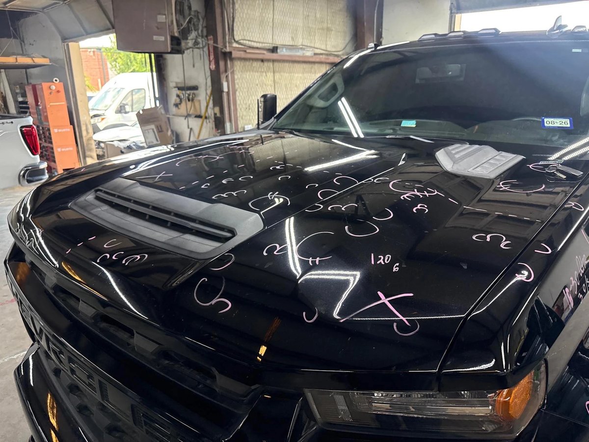
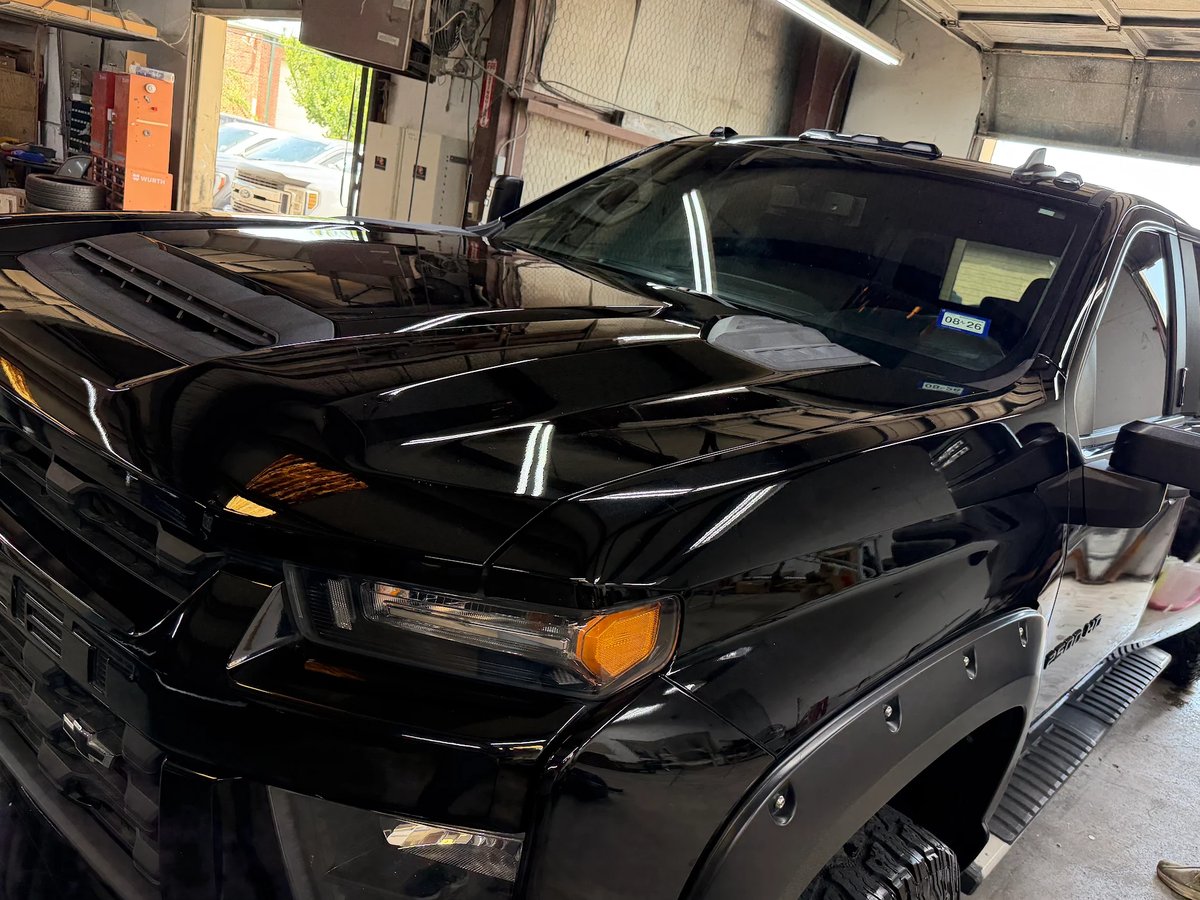
Silverado Hood — Marked, Counted, Then PDR
Pictured: a customer’s Silverado — every strike circled and numbered before a tool touched it. On a claim filed long after the storm, this document does the talking with the adjuster
 Before
After
Before
After
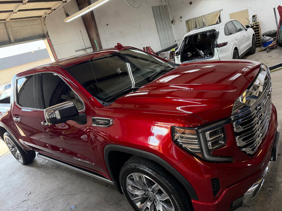
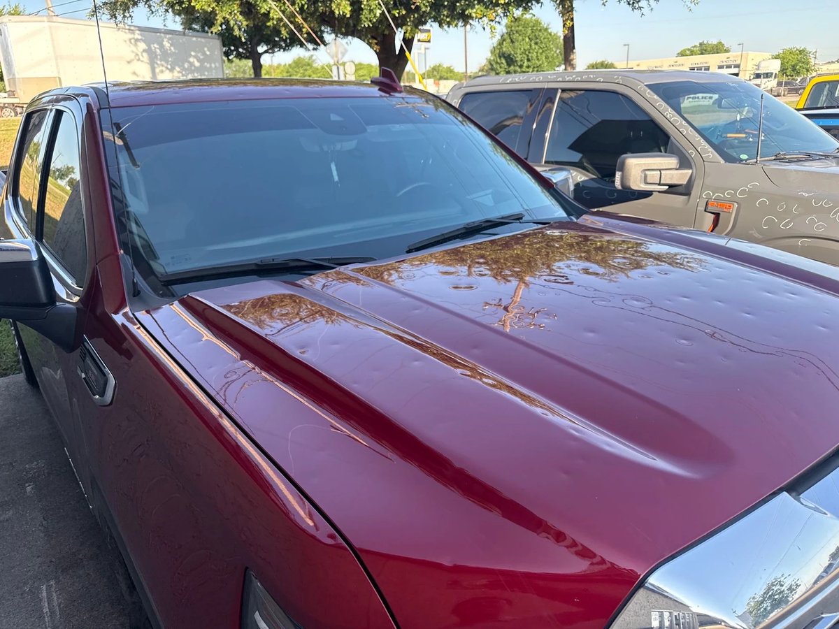
Sierra Denali — Full-Vehicle Hail Repair
Pictured: a customer’s Sierra Denali — the whole-topside damage class an evening of hen-egg-and-up stones leaves behind, taken back to straight panel by panel
June 1, 2025 Storm Questions